California Storm Sequence: Coastal Warnings, Sierra Snow and a Flooded Detour
Forecasts call for rain, dangerous surf and mountain snow through the weekend and into next week, while Wilmington flooding adds a local road complication; several effects remain unresolved.

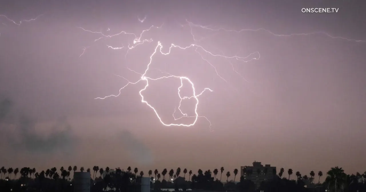

A run of storms reached California, with the first system dropping most of its rain in Northern California before delivering scattered showers to Southern California on Thursday. The heaviest part of that first storm began Friday, the account states. Widespread rain was forecast to begin late Friday afternoon and last into Saturday morning, with totals possibly reaching 0.25 to 1 inch by Saturday. Mike Wofford, who works for the National Weather Service in Oxnard, described the rain as mostly light but said heavier periods could not be excluded. Forecasters also said minor flood advisories might be issued over the weekend. [1]
A break was forecast for Saturday afternoon into Sunday. Another system was expected Monday night with totals of 0.25 inch or less, and a third was likely to arrive Thursday with another 0.25 to 1 inch, the weather service forecast. Ryan Kittell, an Oxnard-based weather service meteorologist, said neither of those later storms was expected to produce major impacts. Those are forecasts and attributed expectations, not confirmed results. [1]
In Wilmington, the Los Angeles Fire Department counted five vehicles stuck in floodwater Friday morning. KTLA-TV reported that one was a semitruck and that rain combined with high tides appeared to have caused the flooding. Department spokesperson Jamie Stewart said firefighters were called at about 5:20 a.m. to Harry Bridges Boulevard and Broad Avenue. Nobody was trapped, and the department reported no injuries. [1]
The flooded road serves as a detour around the Vincent Thomas Bridge, which links San Pedro and Terminal Island and is closed for construction for 16 months. In a post on X, Los Angeles County Supervisor Janice Hahn said city and county crews were pumping water but that commuters could not keep being sent through a route that was flooding. She asked Caltrans to find a different detour that steers traffic away from Harry Bridges and Alameda while a lasting solution is sought. [1]
Advertisement
Los Angeles County beaches could see moderate coastal flooding at times, especially Saturday, according to the National Weather Service. Possible effects included erosion ranging from moderate to significant and shallow inundation of beaches and walkways that are usually dry. A high-surf advisory was set to run through Tuesday because of two large swells. The first was expected from Friday into Saturday; the second was due Monday. Bryan Lewis, a weather service meteorologist in Oxnard, said west-facing beaches could see 8- to 12-foot surf, with lower heights in some places depending on how the coastline is oriented. [1]
Forecasters warned swimmers about dangerous rip currents, advised swimming only near a lifeguard, urged people to stay off rock jetties and told them to follow local officials. The largest surf was expected along west- to northwest-facing shores, with a peak Saturday and a possible build again Monday, the weather service forecast. The forecast said erosion and shallow seawater flooding over low-lying beach walkways, parking areas and roads were likely, particularly in the morning near high tide. Waves breaking at the Ventura Harbor entrance could also affect that area, according to the forecast. [1]
The Central Coast carried the highest stated risk in the forecast. The weather service said waves of 18 to 25 feet could harm piers, coastal roads and structures, and high-surf and coastal-flood warnings were in effect. Forecasters cautioned about breaking waves at the Morro Bay Harbor entrance and at the Pismo and Cayucos piers. They also cited possible widespread flooding on low-lying sandy beaches such as Oceano Dunes State Park, particularly at high tide. [1]
The Santa Cruz County Sheriff’s Office and the Capitola Police Department issued evacuation warnings for low-lying coastal areas. They cited hazardous surf and large waves that could flood dangerously and make access unsafe. The warnings were in place as of Friday afternoon and covered Potbelly Beach Road, Las Olas, Rio Del Mar’s Beach Drive and Capitola Village. Authorities strongly encouraged residents to consider leaving until conditions improved. [1]
Advertisement
The forecast hazards also led to temporary closures at several state beaches, including Carmel River State Beach, Asilomar State Beach and the Coastal Trail in Monterey County, along with all city beaches in Santa Cruz. Santa Cruz planned to close its wharf between 10 p.m. Friday and 5 a.m. Sunday. Santa Cruz Fire Chief Rob Oatey said in a statement that going into the water or nearing dangerous coastal areas endangers both the person and rescue personnel. He urged people to honor the closures and give the ocean space. California State Parks canceled beach camping at Oceano Dunes through Monday and suspended day-use vehicle access at Oceano and Pismo State Beach on Saturday, saying restrictions could be extended depending on conditions. [1]
The storm was forecast to bring heavy snow to the eastern Sierra, especially from Mt. Whitney north to Aspendell, where up to a foot could fall over the weekend. The weather service warned Friday that travel could range from very difficult to impossible. It said the Friday evening commute would be affected, strong winds could extensively damage trees and power lines, and roads, bridges and overpasses would likely become slick and hazardous. The source does not report whether such damage occurred. [1]
Gusty southwest-to-northwest winds were expected Friday, with sustained speeds near 20 mph and gusts reaching 30 to 35 mph across inland Los Angeles County. In the eastern Sierra, the warning said strong winds could cause extensive damage to trees and power lines. Whether winds produce outages or blocked roads beyond the snow zone remains an open question, not a confirmed outcome. [1]
In Kern County, the Frazier Park and Pine Mountain Club areas may receive a little snow Tuesday, Kittell said. In the San Bernardino Mountains, cold temperatures allowed the Big Bear snow play area to open Friday morning for snow tubing. Temperatures were expected to fall about 10 degrees more in the evening and remain in the mid- to high 60s through the rest of the week starting Friday. The weather service’s Oxnard office said the lower temperatures came from a long-awaited offshore pattern that was finally turning onshore. [1]
Advertisement
The supplied account offers only limited historical context. It identifies the Vincent Thomas Bridge as closed for construction for 16 months and says the cooler temperatures were tied to an offshore pattern that had long been anticipated before it swung onshore. It provides no prior-storm comparisons, no historical rainfall records and no climate attribution. Those omissions limit what can be said about whether this sequence is unusual. [1]
The account places mountain travel warnings, coastal flood and surf warnings, evacuation warnings, beach and wharf closures, canceled camping and vehicle access, and a flooded detour around a long-term bridge closure in the same forecast window. That combination means restrictions are not uniform: mountain, coast and local road conditions each carry separate guidance. The source does not rank the event’s severity, compare it with past storms or state that it is unusually strong. [1]
Several factual questions remain unanswered. The source does not say how many people evacuated, whether evacuation warnings were upgraded, the total damage from flooding or surf, or whether Caltrans identified an alternate detour avoiding Harry Bridges and Alameda. It reports no injuries and no one trapped in the Wilmington flooding, and it describes closures and warnings as of Friday. It does not provide later updates on those conditions. Open questions also include whether minor flood advisories are issued over the weekend; whether coastal flooding and erosion reach the warned moderate-to-significant levels, especially Saturday morning near high tide; and whether breaking waves affect the Ventura Harbor entrance, the Morro Bay Harbor entrance and the Pismo and Cayucos piers. The source also does not say whether any evacuation warnings were lifted or extended after Friday. [1]
Key unknowns remain tied to timing and local conditions. The source does not state exact high-tide times beyond saying morning high tides are a concern, does not give rainfall rates, and does not say whether minor flood advisories were actually issued. It also does not report whether any evacuation warning was extended or lifted after Friday, whether Caltrans named an alternate detour, or whether the wharf and state beach restrictions were later changed. Those gaps mean the account establishes forecasts, warnings and early reports, not final outcomes. [1]
Advertisement
The timeline to watch is rain from late Friday afternoon into Saturday morning; a reprieve Saturday afternoon into Sunday; a second system Monday night; and a third system likely starting Thursday. A high-surf advisory runs through Tuesday, with surf expected to peak Saturday and potentially build again Monday. Heavy snow was forecast in the eastern Sierra over the weekend, and a little snow was possible in the Frazier Park and Pine Mountain Club areas on Tuesday. These are forecasts and attributed expectations, not confirmed outcomes. [1]
Other questions are whether Santa Cruz wharf and beach closures remain in place, whether State Parks extends the Oceano and Pismo restrictions, and whether Caltrans identifies an alternate detour avoiding Harry Bridges and Alameda. Residents and travelers face multiple localized restrictions rather than one uniform hazard, according to the source’s account. The source does not say how long restrictions will last beyond the stated dates. [1]
Sources
Prepared with AI assistance from the cited sources.
The Cali Reporter newsletter
The stories worth your time.
California, the country, and what comes next. Join our free newsletter for reporting that keeps you informed.
More in Los Angeles
- Los Angeles Officials Reach Preliminary Agreement on Olympic Contracts
Los Angeles officials have reached an unprecedented preliminary agreement to ensure local businesses receive a meaningful share of the estimated $4 billion in contracts for the 2028 Summer Olympics.
- California's New Insurance Commissioner Proposes Government-Run Wildfire Program
California's new insurance commissioner, Jane Kim, has introduced a plan to create a government-run wildfire insurance program aimed at addressing the state's growing home insurance crisis.
- Surfing Legend's Murder Investigation Expands
New evidence has emerged in the murder case of Kurt Van Dyke, a renowned California surfer, revealing a broader involvement of individuals beyond his girlfriend.